|
Forests are on the move across North America. Scientists are keeping a special eye on Minnesota, where coniferous boreal forests (taiga) dominate the northern part of the state, with deciduous forests in the middle of the state, and prairie in the south. Changes in climate are pushing out the boreal forest -- Minnesota's famous North Woods -- with the deciduous forest and the prairie both expanding north.
"[Lee Frelich, director of the University of Minnesota's Center for Forest Ecology] thinks the boreal forests that soak up huge amounts of carbon dioxide from the atmosphere could disappear entirely, taking with them a third of the state's native species of trees, flowers, birds and pollinators. In an extreme scenario, he has warned, prairie land could expand across much of Minnesota by 2100, upending everything from the timber industry to tourism to the state’s very identity. 'Minnesota could become the new Kansas,' he said. 'We have a perfectly good Kansas now. We don't need a second one in Minnesota.' ... A Washington Post analysis of historical temperature data found that seven counties in Minnesota [including the county that contains the headwaters of the Mississippi River] have warmed more than 2 degrees Celsius since the late 19th century — about twice the global average. Winters here have warmed even faster, with 59 of the state's counties — about two thirds — eclipsing the 2C threshold during the months of December through February. ... That fast change contributes to some 'zombie' forests in parts of the state, said his colleague Stephen Handler, a Forest Service climate change specialist. 'There are places where climate change is already influencing forest regeneration,' Handler said. 'Big, healthy trees overhead — but on the forest floor, no baby trees to fill in the gap.'" www.washingtonpost.com/graphics/2020/climate-solutions/climate-change-minnesota/
0 Comments
Volcanic eruptions have changed the course of human history many times across the millennia. New research finds that a volcanic eruption in the Aleutian Islands, 6000 miles from Italy, may have contributed to the end of the Roman Republic. "In recent years, geoscientists, historians and archaeologists have joined forces to investigate the societal impacts of large volcanic eruptions. They rely on an amalgam of records — including ice cores, historical chronicles and climate modeling — to pinpoint how volcanism affected civilizations ranging from the Roman Republic to Ptolemaic Egypt to pre-Columbian Mesoamerica. ... Dr. [Joseph] McConnell and his collaborators recently analyzed six ice cores drilled in the Arctic. In layers of ice corresponding to the early months of 43 B.C., they spotted large upticks in sulfur and, crucially, bits of material that were probably tephra. The timing caught the scientists’ attention. Researchers have previously hypothesized that an environmental trigger may have helped set in motion the crop failures, famines and social unrest that plagued the Mediterranean region at that time. ... There’s good evidence that the Northern Hemisphere was colder than normal around 43 B.C. Trees across Europe grew more slowly that year, and a pine forest in North America experienced an unusually early autumn freeze. Using climate models to simulate the impact of an Okmok [Aleutian volcano] eruption, Dr. McConnell and his collaborators estimated that parts of the Mediterranean, roughly 6,000 miles away, would have cooled by as much as 13.3 degrees Fahrenheit. 'It was bloody cold,' Dr. McConnell said. Rain patterns changed as well — some regions would have been drenched by 400 percent more precipitation than normal, the modeling revealed. ... These cold, wet conditions would have almost certainly decimated crops, Dr. McConnell and his colleagues said. Historical records compiled by Roman writers and philosophers note food shortages and famines. In 43 B.C., Mark Antony, the Roman military leader, and his army had to subsist on wild fruit, roots, bark and 'animals never tasted before,' the philosopher Plutarch wrote." www.nytimes.com/2020/06/22/science/rome-caesar-volcano.html
If you've ever looked at a map of Minnesota, you may have noticed the "bump" at the top, just west of center. If you look more carefully, you will notice that the land part of that bump is actually detached from the rest of the state. That bit of land is known as the Northwest Angle. It is the northernmost point in the lower 48 states and effectively an exclave of the U.S. The 120 or so permanent residents make most of their money providing services for recreational fishermen. June is normally their busiest month, but with the U.S-Canada border still closed because of COVID-19, business is slow. At present, Americans can only access the Northwest Angle via boat across the large and sometimes temperamental Lake of the Woods. www.nationsonline.org/maps/USA/Minnesota_map.jpg
River deltas, the fans and fingers of land created when the sediment carried by a river settles out at the river's mouth, grew by an average of 54 square kilometers per year between 1985 and 2015. A quarter of that growth was due to greater upstream erosion caused by deforestation "freeing soil from the grip of tree roots, allowing rivers to carry more of it downstream." More than half the global growth in deltas occurred in South, Southeast, and East Asia. North America, by contrast was the only continent to lose delta area, "partly due to damming along the Mississippi River."
Dutch researchers "examined 10,848 deltas to quantify humans’ impact. Three primary forces shape deltas: rivers delivering sediment; tides pushing or pulling sediment; and waves redistributing sediment along the coast. Humans exert a lot of control over how much sediment a river carries: While deforestation feeds the flow of soil, dams plug it up. ... In about 1,500 deltas, soil erosion due to deforestation increased sediment loads by more than 50 percent. ... Dams reduced sediment supply by more than 50 percent in 970 other deltas." www.sciencenews.org/article/many-river-deltas-are-growing-fed-human-caused-erosion The holiday season is filled with traditional desserts. For a nontraditional dessert, you might want to try seaweed pie. The catch? It is only served at the potato museum on Canada's Prince Edward Island. Seaweed pie is made from Irish moss, an edible seaweed that used to be central to the economy of Prince Edward Island, where it was gathered and sold for use as a food thickener and in toothpaste. Irish moss continues to be harvested elsewhere for these purposes, but on Prince Edward Island, the pie is pretty much all that remains of the Irish moss trade. www.atlasobscura.com/foods/seaweed-pie
With Saudi Arabia's state-owned oil company, Saudi Aramco, heading for an initial public offering (IPO) it seemed timely to share this set of maps from Visual Capitalist, detailing the world's biggest oil discoveries since 1868. www.visualcapitalist.com/map-worlds-biggest-oil-discoveries-since-1868/
Assembling data from nearly 7000 sites around the world, researchers have assembled the first map of global earthworm distribution. "During the 1800s, intrepid explorers collected and cataloged many of the world’s plants and animals, providing range maps for different species that launched further study. But that wasn’t true for subterranean life. ... [E]arthworms have been studied long enough in Europe that most of the species are known. (The United Kingdom has 33 kinds.) But in the tropics, 'Every time they dig a hole, they find a new species of earthworm,' [soil ecologist Helen] Phillips says. ... [Researchers] were surprised when their analysis showed that temperature and rainfall seem to have a greater influence on where earthworms do best than soil type, they report today in Science. ... The effects of temperature and rainfall suggest climate change will have a far greater influence on below-ground life than expected, they say. Consequently, life above ground might also be affected in ways not previously anticipated. The distribution of different earthworm species was also surprising. When it comes to life above ground, the tropics have the greatest biodiversity. But underground, these constantly warm regions are far less diverse, at least at a local scale: The rich soils of Europe, the northeastern United States, the southern tip of South America, and the southern regions of New Zealand and Australia seem to have more earthworm species in a given area. Those temperate zones also host more earthworms overall, according to the model, with up to 150 per square meter versus just five per square meter in the tropics." www.sciencemag.org/news/2019/10/first-global-map-earthworms-reveals-which-places-are-chock-full-them-and-why
Recent protests and elections in Chile and Argentina, respectively -- countries generally considered among South America's wealthiest -- have highlighted a high level of public dissatisfaction. This map, from The Economist (UK) and based on 2018 data, looks at the proportion of adults across Latin America who agree that they want to leave their country. Not surprisingly, countries like Venezuela (hyperinflation), Honduras and El Salvador (violence), and Haiti (poverty) rank highly, but nearly 1/3 of adults across the region want to emigrate. www.economist.com/graphic-detail/2019/09/07/nearly-a-third-of-latin-americans-want-to-emigrate
This GIF from the National Audubon Society and the Cornell Lab of Ornithology shows annual bird migrations in the Western Hemisphere. (These maps are based on bird observations from 2002 to 2014 and do not necessarily reflect the recent data finding that North America has lost nearly 30% of its bird population since 1970.) www.audubon.org/news/see-millions-places-migrating-birds-have-gone-one-gif
During the last ice age, global geography would have appeared quite different, with extensive land and sea ice lowering ocean levels significantly. This Reddit map tries to recreate global geography as it would have existed 21,000 years ago. Although the ice coverage is eye catching, a careful look at southeast Asia, western Asia, and Oceania, for example, shows the way a drop in sea level changed the geography of these regions dramatically, a history that still echoes in their biogeography. i.redd.it/drvhvjbtw3b31.jpg
The U.S. recently marked the 400th anniversary of the arrival of the first ship of enslaved people from Africa to U.S. shores. Yet, as my "Your Future World" students are always surprised to learn when we study Brazil, the U.S. accounted for only about 3% of the Transatlantic slave trade, with Brazil accounting for about 40% and the Caribbean accounting for another 40-45%. This map shows both destinations and origins of enslaved people, some of whom were from coastal communities in western Africa while others were captured in interior regions and sold to slavers at the coast. www.statista.com/chart/19068/trans-atlantic-slave-trade-by-country-region/
Greenland, which is administered by Denmark, has been in the news lately. Greenland is the world's biggest island. This map shows the world's 10 biggest islands: www.statista.com/chart/19047/total-area-of-the-worlds-largest-islands/ It should be noted, though, that because of the mapping projection used, the size of Greenland and the other Arctic islands is greatly magnified. (My "Hands-On Geography" students sometimes ask, "Why is Greenland an island and Australia isn't?" There is no excellent answer to this question. You will find things like this www.worldislandinfo.com/CONTISLAND.html online, but Australia was named a continent prior to a scientific understanding of tectonic plates and the flora and fauna are not truly unique in that there are striking similarities to species in Indonesia and the Philippines east of the Wallace Line. In other words, geographers lucked into some scientific support for their classification of Australia, and not Greenland, as a continent rather than an island.)
What do France, Haiti, and India (shown in red on this map) have in common? Liberté, égalité, and fraternité (or liberty, equality, and fraternity or brotherhood). "Liberté, égalité, fraternité" is the national motto of both France and Haiti. The English equivalent features prominently in the preamble to the Indian constitution. The phrase has its origins in the French Revolution, which will be marked in France by Bastille Day tomorrow. 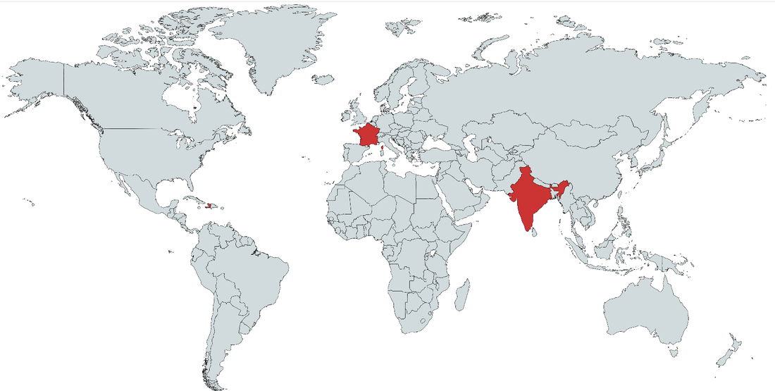 This geo-graphic compares health care expenditures to life expectancy for 32 countries in the Americas: howmuch.net/articles/the-state-of-worlds-health
This map, created by a Reddit user, shows Canada divided into four equal areas by population. (The red region at the western end of Lake Ontario is sometimes referred to as the Golden Horseshoe.)
www.reddit.com/r/MapPorn/comments/bw6y6g/canada_divided_into_four_regions_of_equal/ Although the National Hockey League started as a wholly Canadian league, today the preponderance of teams play in the U.S. The league continues to draw players from many countries, though. This interactive map looks at the birth places of the players on the four teams currently vying for hockey's Stanley Cup: the Boston Bruins (the first U.S. team in the NHL), the St. Louis Blues, the San Jose Sharks, and the (Raleigh, North) Carolina Hurricanes. www.mapotic.com/stanley-cup-2019
This Reddit map shows the most common biome on the planet: the taiga, or boreal forest, that covers the northern stretches of Europe, Asia, and North America. The map itself is unusual because the center, of course, is "north," and "south" is in every other direction. (The red line demarcates regions of the taiga that are believed to be suitable for sustainable logging.) preview.redd.it/x0amkyci3md21.jpg?width=960&crop=smart&auto=webp&s=a58cada083240efa536848b325aa2f1f45c76040
Subsidence is the phenomenon of land sinking. This can happen for a variety of reasons, but one of the most common has been pumping water out of aquifers, causing the overlying land to sink. Jakarta and Mexico City are both experiencing subsidence. Now you can add Tehran to the list. Decades of overpumping of Tehran's groundwater have caused water tables to drop by as much as 12 meters, and the overlying land to sink by several meters. Subsidence can crack streets and building foundations and rupture underground pipes. geographical.co.uk/places/cities/item/3052-sinking-tehran
Which countries would be the primary sources of voluntary immigration if possible? This geo-graphic looks at the proportion of countries' adult populations that would emigrate if possible. (Of the top 10, five are in Africa, three are in North America, and two are in Europe.) While most of these countries are small, two of the countries -- Nigeria and the DRC -- are also forecast to be among the world's 10 most populous by 2050. www.statista.com/chart/16363/share-of-adults-who-have-a-desire-to-migrate/
Scientists analyzing the massive 8.2 earthquake that rocked Mexico in September 2017 have found that the earthquake actually broke the Cocos tectonic plate in two.
www.nationalgeographic.com/science/2018/10/news-tectonic-plate-split-earthquakes-tsunamis-geology The World Bank has announced that extreme poverty (defined as living on income of less than $1.90 per day) has fallen to a record low 10% of global population. These maps look at extreme poverty rates globally and by continent. howmuch.net/articles/people-living-in-extreme-poverty-2018
This interactive mapping site allows you to enter any location in North America, Australia, or New Zealand, as well as parts of South America and Greenland, to find out which indigenous people(s) used to live where you do now. native-land.ca/
Immigration goes both ways across the U.S.-Mexico border: the map on the lower left shows that Americans are the largest immigrant population in all but four of Mexico's 31 states. The center map shows the source country for each Mexican state's second-largest immigrant community. www.reddit.com/r/MapPorn/comments/99e600/country_of_birth_of_the_2nd_most_common_immigrant/
The warming of lakes in the Arctic is thawing methane, the primary component of natural gas, causing shorelines to collapse and water to hiss, bubble, and even burn. Methane is a potent greenhouse gas. Its release from permafrost and frozen lake bottoms may dramatically accelerate warming trends, part of a positive feedback loop in the Arctic and beyond. www.adn.com/arctic/2018/09/24/across-the-arctic-lakes-are-leaking-dangerous-greenhouse-gases/
This geo-graphic looks at land loss in coastal countries between 1961 and 2014. The Caribbean island nation of St. Kitts and Nevis (southeast of Puerto Rico) lost more than 25% of its territory in this ~50 year period through a combination of natural erosion, rising seas, and hurricanes and other natural disasters. Territorial loss has been calculated using annual World Bank land mass data. www.statista.com/chart/1740/land-area-lost-since-1961/
|
Blog sharing news about geography, philosophy, world affairs, and outside-the-box learning
Archives
December 2023
Categories
All
|
 RSS Feed